What Is a Site Plan and When Do You Need One?
What is a site plan and when do you need one? What it shows, which projects require it, who draws it, and how to get one now.
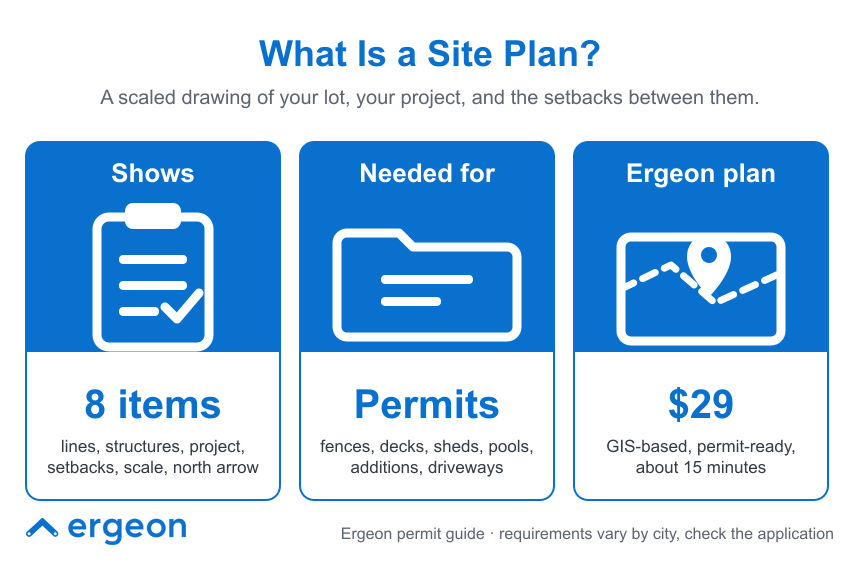
A site plan is a scaled, top-down drawing of your property that shows the lot lines, everything already built on the lot, and whatever you are proposing to build, with the distances between them measured and labeled. Permit offices use it to check that a fence, deck, shed, pool, addition, or driveway sits where the zoning code allows, which is why nearly every residential permit application asks for one. You need a site plan whenever a project changes what is on the lot or where it sits, and you want one even without a permit when a project runs along a property line. It does not have to be a stamped survey, and for most residential work it should not cost more than a nice dinner. Ergeon generates a permit-ready, GIS-based site plan for $29 in about 15 minutes, and this guide covers what the drawing is, what it must show, which projects require it, who can prepare one, and how to get it without waiting weeks.
Think of it as a map of your lot at a scale a reviewer can measure with a ruler. A residential site plan is usually drawn at 1 inch equals 10 or 20 feet on an 11 by 17 sheet, oriented with a north arrow, and it contains two layers of information:
The distances are the point. A zoning code says a side fence may be 6 ft tall but must drop to 4 ft within the front setback, or that a shed must sit 5 ft off the rear line, or that a pool needs a barrier a certain distance from the water. The site plan is how the reviewer checks those numbers without visiting the lot.
A site plan is not a survey. A survey is a licensed surveyor's legal determination of where the boundary sits, stamped and set in the ground. A site plan is a drawing for review, and for residential work its property lines usually come from county parcel records rather than field measurement. Ergeon's guide to site plan vs. survey vs. plot plan sorts out the three terms.
Permit checklists vary by city, but the core elements are consistent:
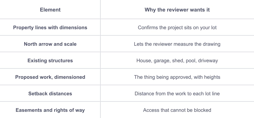
Some offices also want impervious surface calculations for patios and driveways, finished floor elevations for additions, or tree locations where tree ordinances apply. The permit application for your project type will list the exact requirements, and that list is the only one that matters.
Almost any project that adds, moves, or enlarges something on the lot:
Projects that generally do not need one: interior remodels, roof replacement, window and door swaps in existing openings, and like-for-like repairs that do not change a footprint. A fence repair that replaces pickets on an existing line is a repair. A fence that moves the line or changes height is a project.
Three situations, all of them about avoiding an expensive conversation later:
For residential permits, almost anyone, as long as the drawing is to scale, accurate, and complete. The options, roughly from slowest and most expensive to fastest and cheapest:
The full cost comparison is in Ergeon's guide to how much a site plan costs.
One caveat applies to any site plan drawn from records: parcel data is a starting canvas, not a legal boundary determination. Only a licensed surveyor can establish your property line. For a permit and a cooperative neighbor, the drawing is enough. For a dispute, order the survey.
Ergeon uses the same GIS site plan as the base for its own permit filings, adding your fence layout and any other documents the city requires on top. If your fence needs a permit, the project manager handles the application after you approve the quote. The quote itself is built on a live video call without a sales visit: you draw the line on a satellite map, a specialist confirms slope, gates, access, and removal on camera, and the itemized price comes from a CAD model that carries real materials, quantities, labor, and live pricing. Ergeon is licensed, bonded, and insured in every market it serves, holds a 4.81 out of 5 rating across more than 22,000 verified reviews, and typically schedules builds within about 20 days of approval. See how it works or call 1-888-374-3661.
What is a site plan?
A scaled, top-down drawing of your lot showing property lines with dimensions, existing structures, your proposed project, and the setback distances between them, with a north arrow and scale. Permit offices use it to check a project against zoning rules.
When do you need a site plan?
For nearly any permit that adds or moves something on the lot: fences, decks, sheds, pools, additions, driveways. You also want one without a permit when a project runs along a property line, when an HOA has to approve it, or when you want several contractors pricing the same drawing.
Does a site plan have to be prepared by a surveyor?
Usually not. Most residential permit offices accept a scaled drawing from records. A surveyor-certified plan is required only when the checklist says certified or stamped, a variance is involved, or the boundary is disputed.
How much does a site plan cost?
From $29 for Ergeon's GIS-based plan in about 15 minutes, to roughly $89 to $259 from online drafting services, $150 to $400 from a local drafter, and $1,000 or more for a surveyor-certified plan.
Is a site plan the same as a plot plan?
For residential permits, yes. Plot plan is the older term for the same drawing. In a few jurisdictions a "certified plot plan" specifically means a surveyor-prepared document, so read your checklist.
Get a free fence quote - Call 1-888-374-3661. Monthly-payment financing is available on qualifying projects.
 Local Guides
 Local Guides
 Local Guides


